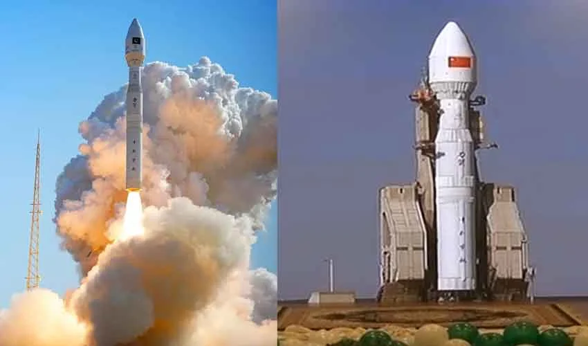
Pakistan took a historic leap in space technology with the successful launch of its first hyperspectral imaging satellite, HS-1, from China.
The satellite, launched in the presence of Pakistani scientists from the Jiuquan Satellite Launch Centre in China, promises to revolutionise environmental monitoring, urban planning, and agricultural management across the country.
The launch of HS-1 was celebrated at a special ceremony organized by the Space and Upper Atmosphere Research Commission (SUPARCO) in Islamabad.
Observation of Earth from every inch
Speaking at the event, Space Technology Secretary Brig Aftab called the day a “historic moment for Pakistan in the field of space.” He highlighted that the satellite would enable Pakistan to observe “every inch of the Earth” with advanced hyperspectral precision.
Also read: SUPARCO to showcase satellite-powered ‘Sky Clinic’ at ITCN Asia 2025
This mission, he said, represents a major step toward self-reliance in space science and technology — one that aligns with Pakistan’s National Space Policy and Vision 2047.
Power of HS-1: High-tech observation across 130 bands
The HS-1 hyperspectral imaging satellite is equipped with cutting-edge sensors capable of capturing data across 130 spectral bands, allowing for detailed observation of land, water, and atmospheric conditions.
According to SUPARCO, HS-1 will play a crucial role in:
- Monitoring natural disasters such as floods, droughts, and earthquakes.
- Assessing climate change impacts and tracking glacier movements.
- Supporting urban planning and infrastructure mapping.
- Detecting deforestation and tracking city expansion.
The satellite will also help monitor air quality and smog, offering real-time data to improve environmental management and disaster preparedness.
Improving agriculture productivity
One of HS-1’s most significant benefits will be in agricultural productivity. Officials said the satellite’s hyperspectral data will enable more accurate crop monitoring, soil health analysis, and irrigation management — potentially increasing agricultural yields by up to 30%. It will also be able to help increase agricultural production according to the weather.
HS-1 will also help monitor water shortages and their effects on crop and forest health, ensuring timely responses to environmental and climatic challenges.
HS-1 becomes third Pakistani satellite launched into space
HS-1 has become the third Pakistani satellite launched into space in 2025, following the successful missions of EO-1 and KS-1 earlier this year. Together, these satellites represent Pakistan’s expanding space portfolio and growing technical expertise.
National Space Policy and Vision 2047
Brigadier Aftab highlighted that HS-1 is a cornerstone project under the National Space Policy and Vision 2047, which aims to position Pakistan among technologically advanced nations by its centennial year.
“The importance of this technology in monitoring environmental changes has greatly increased,” he said, adding that the data collected from HS-1 will “strengthen Pakistan’s capacity to tackle global challenges like climate change and urbanisation.”
SUPARCO Chairman Muhammad Yousuf Khan extended heartfelt congratulations to the nation on the successful launch of Pakistan’s hyperspectral satellite.
He said that with the government’s support, this national project had become a reality, marking another major achievement in the country’s space journey.
Khan added that SUPARCO is continuing to strengthen its role in Pakistan’s socio-economic development through advancements in space science and technology.
According to the chairman, the satellite will enter its designated orbit later today. He further stated that this is the third satellite launched by Pakistan this year.
The in-orbit testing phase is expected to take around two months, after which the satellite will become fully operational.
Also read: Pakistan ready to launch indigenous EO-1 Satellite this week
According to a statement from the Foreign Office, the satellite launch marks a historic milestone in Pakistan’s space program. It said the satellite, developed by SUPARCO, is equipped with state-of-the-art hyperspectral imaging technology capable of capturing highly precise data across hundreds of narrow spectral bands.
The spokesperson said that HS-1 will enable accurate analysis of land use, crop health, water resources, and urban development, helping Pakistan make data-driven decisions for sustainable growth.
Key role in China-Pakistan Economic Corridor
The satellite will also play an important role in China-Pakistan Economic Corridor (CPEC) development projects by assisting in land monitoring, hazard identification, and infrastructure planning, it added.
Moreover, Deputy Prime Minister Ishaq Dar congratulated Pakistani and Chinese scientists and technical experts on the successful launch. In his message, he praised their dedication, professionalism, and exemplary collaboration on the HS-1 project.
The Foreign Office noted that the successful launch of HS-1 represents a new chapter in Pakistan’s space exploration efforts and reaffirms SUPARCO’s commitment to utilizing advanced space technology for the country’s socio-economic development and national progress.
